Activity 3
Mapping Social Life and Basics of Spatial Data
In this activity you will learn about maps, particularly thematic maps, and how to find and create thematic map image files that you use in Activity 4, visualizing self in relation to society. This page begins with guiding questions that frame this activity along with a video that introduces you to thematic maps and how to find and make your own thematic map image files. Subsequently, key concepts from this video are reviewed and links to thematic map collections are provided to inspire you to find or create your own thematic map image files for use in Activity 4. This page concludes with different academic and news articles/media learners can explore prior to participating in this activity.
Guiding Questions
What are some good sources for quality, large scale thematic maps?
What is one aspect of society that you are interested in, and how can thematic maps help you better understand your relationship to/with it? What sort of maps would you want to use to understand your relationship with it?
Choose two thematic maps that you are interested in analysing in relation to your movement data. Critically analyze these maps. What are their strengths? What are these maps lacking?
What ways do you relate to the map?
Introduction to thematic maps & how to make your own
In this instructional video Natalie Robbins introduces key concepts about thematic maps and illustrates what makes a good thematic map and how to quickly make your own thematic maps.
Key Concepts
Examples of Different Thematic Maps
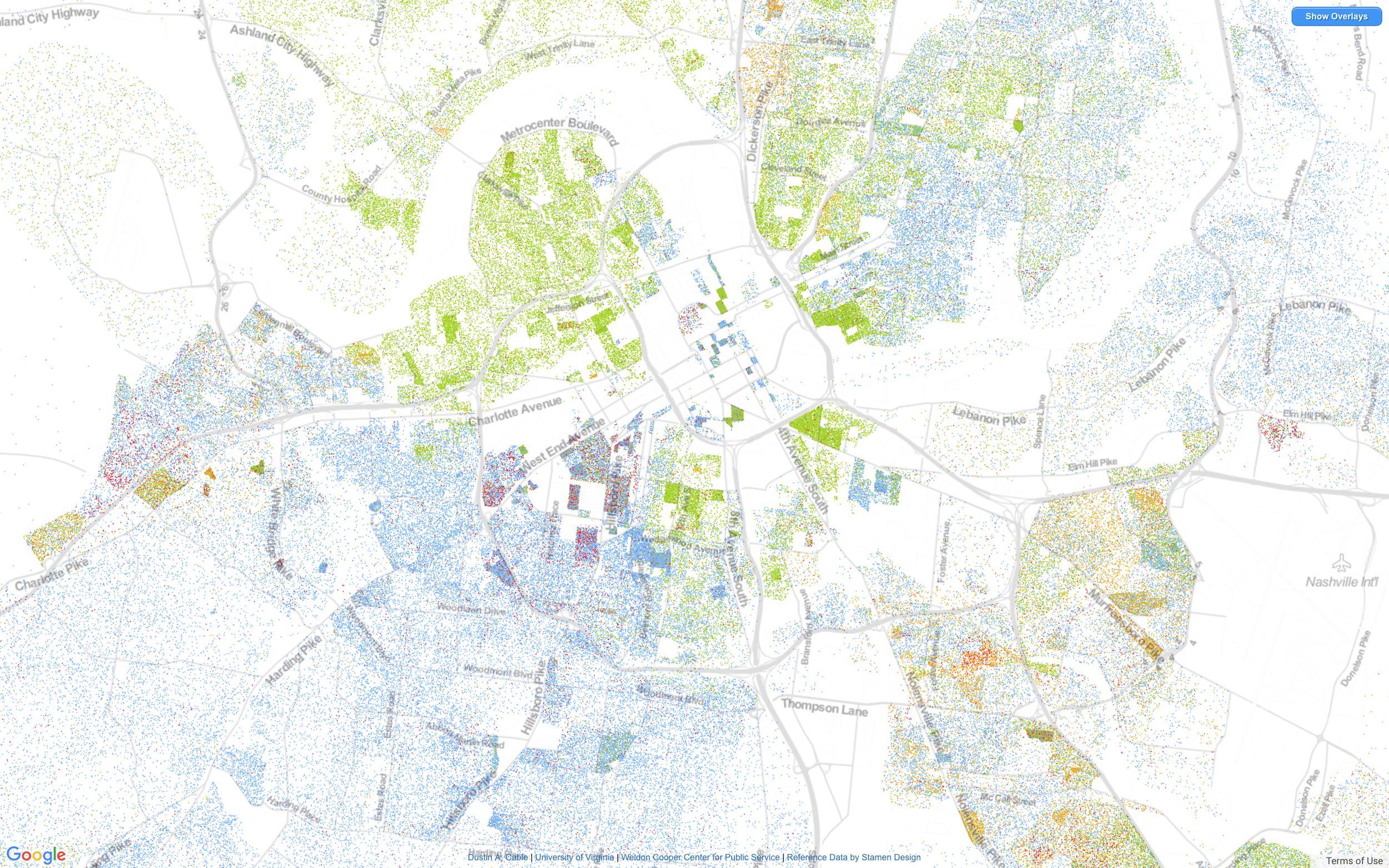
Maps connect your locational data with your surroundings. At its most basic, a map showing your locational data as a series of points is a reference map. When a map shows more information than just location, centered around a certain attribute about a location, it is termed a thematic map. When you introduce the element of time to locational data, you can create a time series map, which is a type of thematic map where the theme is your movement over time. Other types of thematic maps can be created when you start to consider society around and in relation to you. The CDC publishes a variety of thematic maps centering around public health. The Census Bureau is another governmental organization that publishes thematic maps, while also hosting census data that can be used to create your own thematic map. Below are some additional examples of types of thematic maps:
What to Look for in a Good Thematic Map
Legend: There is a legend that is easily decipherable
Spatial resolution: You want large scale maps that show a lot of features within a very small area.
Distinguishing features: Find maps that show features that make it easy to line the map up with the basemap. For example, in Nashville one often looks for the Cumberland River or the U-shaped intersection in front of the state capitol building downtown.
Terminology
Map Scale: What is the difference between a large scale and a small scale map. https://pubs.usgs.gov/unnumbered/70039582/report.pdf
Georeferencing/rectifying: Typically, georeferencing involves overlaying an image above a basemap and aligning known points on the image with the basemap (such as an easily identified street intersection). Terms
Thematic Map Collections
Below are two spreadsheets you can use to find and create thematic maps for your own use and for activity 4 in the MaSelfS framework. The first spreadsheet is a repository of general thematic maps that cover the entire U.S. while the second spreadsheet focuses on Nashville, TN to illustrate the variation in thematic maps that can exist for a single city or place.